The first time I got lost I walked off a switch back, following a wild horse trail over loose shale. Soon the trail disappeared, and I had not left enough sign to track back. I was in a deep mountain valley and couldn’t see any landmarks to shoot off of or orient myself with. As if to punctuate my mistake, menacing looking clouds came in and covered the sun. I was following a mountain trail at about 10,000ft, 10 miles into a 40 mile out and back hike with only one spring to provide water the entire way. I swore to myself that I would buy and learn to use a GPS for emergency situations like this.
I only wanted ONE thing in a GPS: coordinates. That’s it. No annoying crap to download, update, subscribe to, or pay for. I want to know where I am on my map, period. A phone will do this in airplane mode if you have the right app. I like Gaia GPS, AllTrails, and CalTopo. Your phone won’t render maps unless you have service or download them ahead of time, a feature you usually have to pay for. Given the fragility and weight, I elect to leave mine behind.
After many evenings of Googling, I settled on the Garmin Foretrex 401. It seemed simple to operate and is popular with military personnel. I found a new one on eBay for $100, and I was in business. There was a small learning curve, but it was easy to figure out, and easy to get what I wanted out of it. My only complaint was sometimes it would continue to log distance even if I wasn’t moving. The grid it gave was always spot on, but the odometer would artificially inflate my trip distance. I called Garmin and they told me to enable the WAAS (Wide Area Augmentation System) feature, and that would take care of the problem, at the expense of some battery life. WAAS is a navigation aid created by the FAA to supplement the GPS system. I didn’t care much for that answer, as the battery life was only 17 hours at best, but that’s okay. I only wanted to use it when a map and compass weren’t helpful, but the more I used it, the more I liked it.
Recently I started reading about the new Garmin Foretrex 601. Garmin has nearly tripled the battery life over the 401, doubled the resolution (with a larger screen size), added Bluetooth connectivity, more satellite arrays, a 3-axis compass, and NVG compatibility. I was restless from quarantine, and I couldn’t help myself. I had to have it. I sold my 401 for $100, some wheel gun grips for $30, and bought a refurbished Foretrex 601 for $150. Sweet. These go for about $200 brand new. The 701 adds a ballistic computer, but more than doubles the price.
Specifications of the Garmin Foretrex 601:
Dimensions: 2.9” x 1.7” x 0.9”
Display: 2.0” (200 x 128 pixels)
Weight: 3.1 ounces with batteries
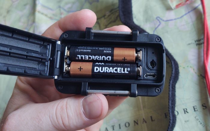
Batteries: (2) AAAs
Battery Life: 48+hrs in GPS mode, 1 week in Ultratrac, and 1 month in watch mode.
The Foretrex 601 has a barometric altimeter, is compatible with Base Camp software, and is water resistant (IPX7, MIL-STD-810). There are 5 screens: map, compass, elevation, trip computer, menu, and you can choose to display a timer screen if you like.
Getting to Know the Garmin Foretrex 601 Screens and Features
The map screen shows your breadcrumb trail, and allows you to view it as north up, or track up. You can choose whether or not to display the satellite icon and the battery icon on this screen. When you choose track up, it displays your heading. There are no downloaded topo maps like other GPS units display. You can use software to plot and import your route, but that looks cumbersome and isn’t something I care to do. Maybe if I was doing an epic hike – like the John Muir Trail – I might work with that feature; but for what I do it is unnecessary.
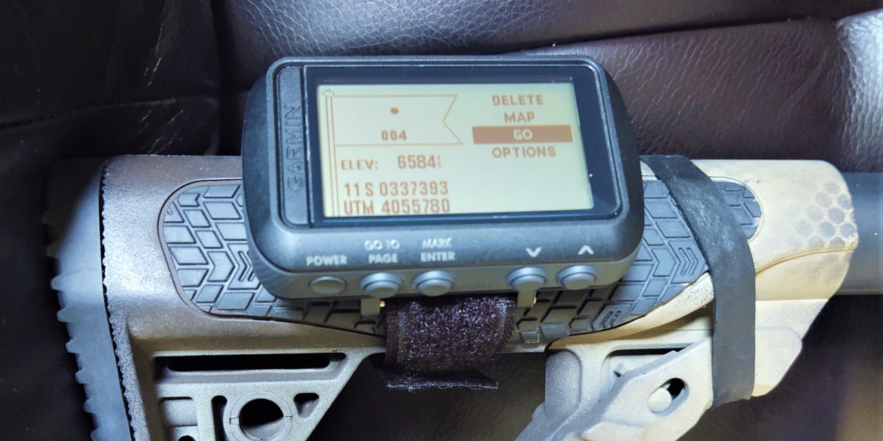
The compass screen shows the compass and has two data fields. Unlike the Foretrex 401, you do not have to hold this one level. You can change the data fields to whatever you wish, but I use “FINAL DIST” and “BEARING.” If you use the track back feature, this is the screen the 601 displays. The FINAL DIST field shows how far I have to go to get to my destination, and the BEARING shows what azimuth I need to follow to get there. I wish I could add HEADING, for three data fields, but this is not possible. You can also choose data fields that show estimated time of arrival, speed, elevation information, and more.
The elevation screen plots your elevation over time or distance and displays your current elevation.
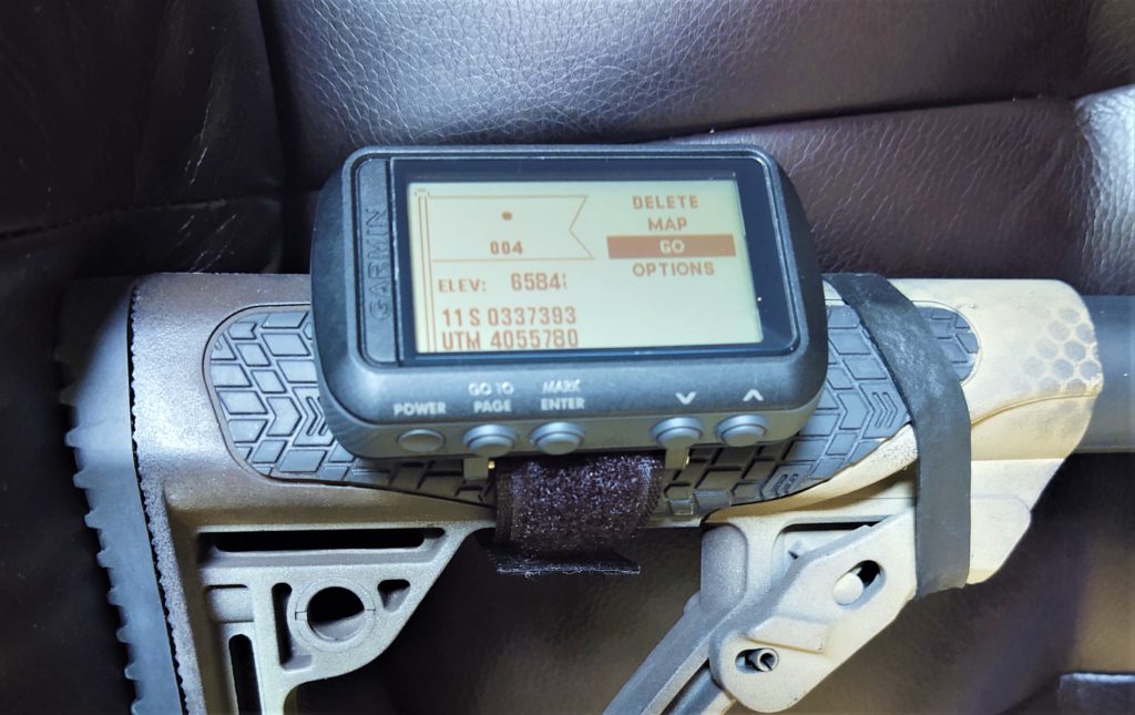
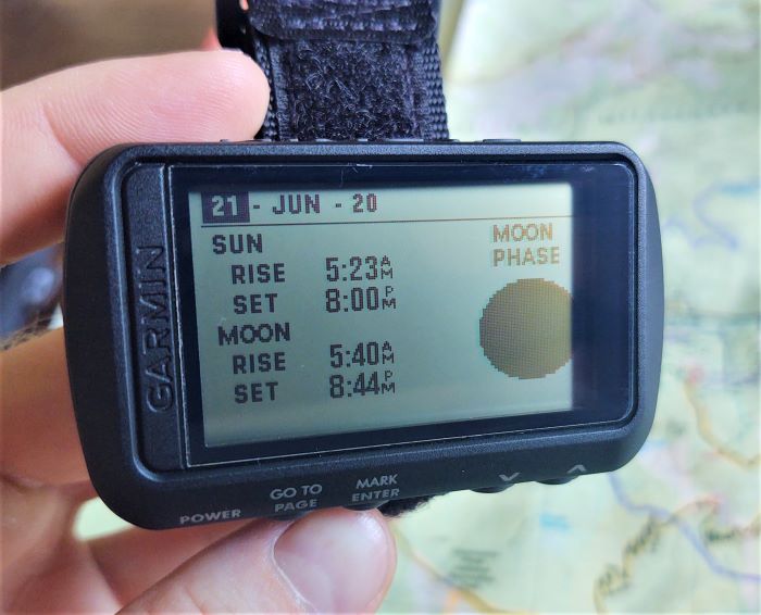
The trip computer screen is my favorite because it gives the most information. I wish I could add data fields, but no such luck. There are 4 small fields (quarter screen), 2 medium (half screen) fields, and 1 large (full screen) field. I use the 4 small fields to display time, heading, moving time, and a trip odometer. You can change these to show lots of different variables, like max/min elevation, total ascent/descent, vertical speed, ambient pressure, barometer, glide ratio, heart rate, max temp, max speed, average speed, sunrise/sunset time, stop time, and more. If you could add more fields and give your pace, it would be an incredible training aid for runners, triathletes, and the like. I use the 2 half screens to display my UTM (Universal Transverse Mercator) grid and elevation. You have the option of displaying your coordinates at the same time in several different formats. I choose to use the UTM system. I think it is simpler than latitude and longitude. I have a sense of how far it is between grid lines, and I never have to convert between minutes and seconds to decimals. The last field I use for sunset time. I like knowing when it will get dark, so I know when I have to start looking for a place to camp.
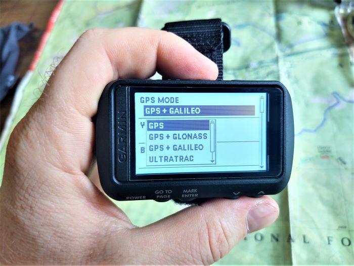
The menu screen is pretty easy to navigate once you look through it. Here you can change units, manage tracks and routes, add way points, use the track back feature, check the moon phase, change your GPS network, and use the jumpmaster feature for HAHOs, HALOs, and static jumps.
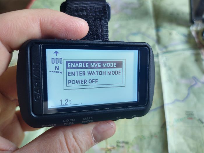
If you tap the power button, it turns on the backlight. If you long press it you can enable NVG mode, enter watch mode, or turn off the unit. Calibrating the compass and altimeter is easy to do.
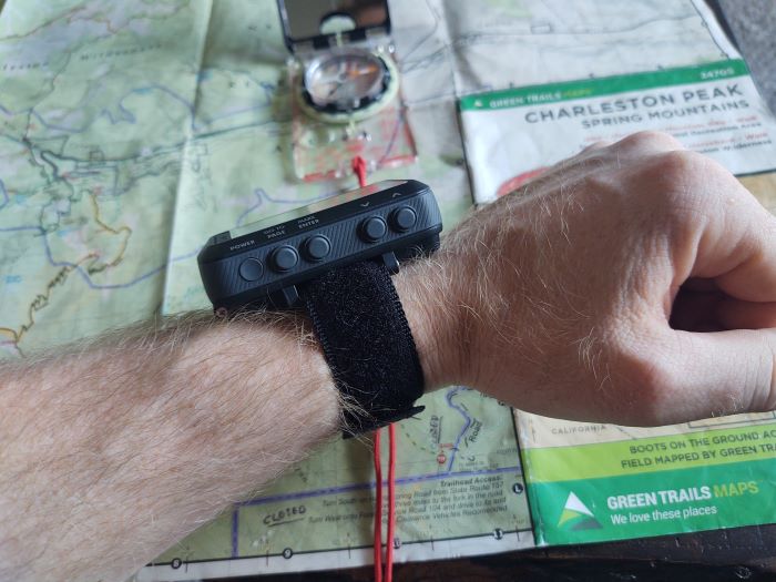
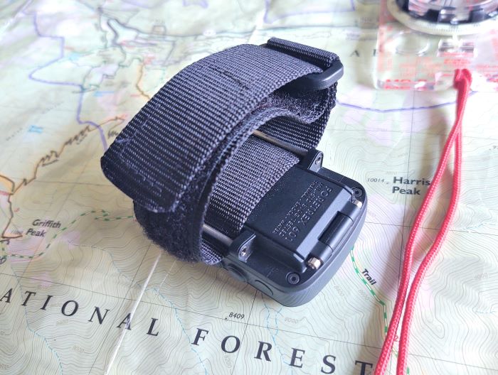
The wrist strap is made in China. It is narrow and feels cheap. The Foretrex 401 wrist strap was wider, nicer, and looked better. This one isn’t as nice as the 401’s, but it works.
Using the Foretrex 601
The first time I used the Garmin Foretrex 601, it was set to the GPS+GLONASS network. It kept losing signal, which really pissed me off. I switched to the GPS+Galileo network, and have had no issues since.
Using the unit is a breeze. Before a journey, I turn it on, allow it to find satellites, and erase my previous trip data. Then I go on my merry way, using my map and compass. If I get in a bind and need to double check where I am, I can do that. I enjoy having access to information like elevation gain, distance, and average speed. If I get REALLY lost, which has happened before, the 601 has an awesome Trackback feature. Trackback directs you along the path you have already taken back to your starting point. This is also perfect if you find you’ve lost something along the way and need to follow your back trail exactly. The compass screen shows the compass and an arrow directing you back on your path. I have it set to show my heading and distance, but you can choose to display your estimated time of arrival. There is also a “GO” feature that is similar to trackback. The unit displays your breadcrumb trail and allows you to select a point on it. The difference is it does not direct you along the trail you took to get where you are now. It simply gives you a bearing from your current location to the selected point. This is a really handy feature, and I love it. You can add waypoints, such as home, trail heads, springs, and other points of interest. Even with WAAS activated, this still logs distances consistently 10% greater than other GPS units. I think it continues to log movement if you stop to rest. This isn’t a huge deal to me, but I do wish it was more accurate. The backlight is wonderful and easy to see even in the bright desert sun.
The Garmin Foretrex 601 is a powerful little GPS. If you put in a little time, it will do all kinds of things for you. Knowing how to use a map and compass is a basic skill every outdoorsman should know, but a GPS can provide you interesting information that can supplement your hike, such as sunset and altitude info. It makes a great backup device for a little extra safety factor.

